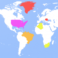
Because it's nearly impossible to accurately represent the sizes of countries (on a round planet) on a flat map, the world maps that we are accustomed to seeing are distorted. This app is a great way to get a real sense of how large different areas of the world actually are. Simply tap and hold on the country you'd like to explore (or state in the US) and it will highlight in a color. You can read more about your selected area (and get a link to a Wikipedia entry about that country/state) or you can move the silhouette around the map and watch it shift sizes as it gets closer to or farther from the equator. This is a great way to, say, compare the size of your home state to a country across the world to get a sense of your place in the world. Great tool for teachers or kids interested in geography! This app has ads, but a small one-time, in-app purchase will eliminate all ads.


